|
Updated May 16, 2019
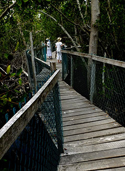
CHAPTER 10: EL COCODRILARIO DE LA MANZANILLA February
28, 2017. We are happy to report that the Crocodile Sanctuary now has a
650-meter-long boardwalk that winds through the estuary, allowing you
to view not only crocodiles, but birds and iguanas as well. See La Manzanilla Crocodile Sanctuary for info and pictures.
CHAPTER 11: LOS AZULES, THE BLUE FALLS
May 12, 2019. While walking the trail I found my previous instructions inadequate. See Los Azules UPDATE for a map showing which way to go at each of the six forks you'll find along the path. You can also download the new track to your GPS if you like. Be careful, this trail is very steep!
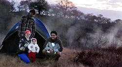
CHAPTER 13: LOS HERVORES
March
2, 2017. Returning to Los Hervores, we discover that the geysers are no
more, but there is still plenty of boiling water, a hot river, a great
hot pool to soak in and a truly ideal place for camping and
star-gazing. See Camping and Hiking at Los Hervores. CHAPTER
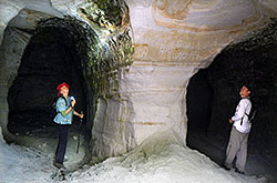
14: LA PAHOLA
January
10, 2015. Camino Arenero is now blocked to vehicular traffic. However,
you can still get to the Pahola Mine by car (OK for any sort of
vehicle) by turning south from Highway 15 (Guad to Nogales) at Avenida
Aviación onto Del Bajio road. Take Del Bajio southwest for two
kilometers. Turn right and go 164 meters west. This same road now goes
north for 829 meters and makes a sharp turn, now taking you southwest.
From this sharp turn drive 1.3 kilometers to the mine.
MUCH EASIER: Follow the latest version of the route on Google Earth. Just go to Guadhikes
- Pahola Kaolin Mine on Wikiloc.com.
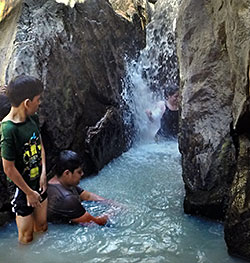
CHAPTER 16: SAN MARCOS
March
7, 2016. The Agua Blanca River has shrunk! Water levels are no longer
high enough for diving or swimming. As a result, few people are going
to the site. We found no one in attendence, the toilets locked and the
road leading to the place badly deteriorated. This was during the
dry season. Maybe the situation is better during the rains, but be
warned!
CHAPTER 18: BOSQUE DE MAPLES
July 2016. For information on two great sites near this extraordinary woods, see Return to the Talpa Maple Forest.
CHAPTER 24: UMA AGUA BLANCA
February
25, 2018. As a result of a reduction in visitors, the UMA looks
abandoned, but the door is always open and, yes, you can visit the
place, hike and do birdwatching. And you can visit the nearby Pyramid
of El Saucillo. Check our Update Report.
|