


|
|
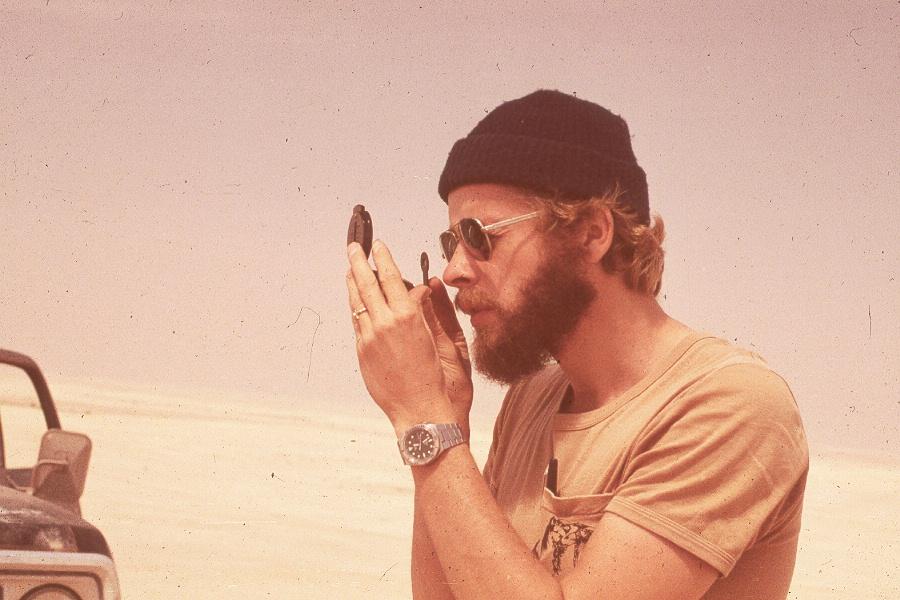
Bruce Davis’s classic article from the NSS NEWS, November, 1983, Pp. 276-284. Reproduced with permission of the author and the NSS.Slightly edited by John J. Pint. Photos by John Pint except where noted. UPDATED SEPTEMBER, 2013 |
|
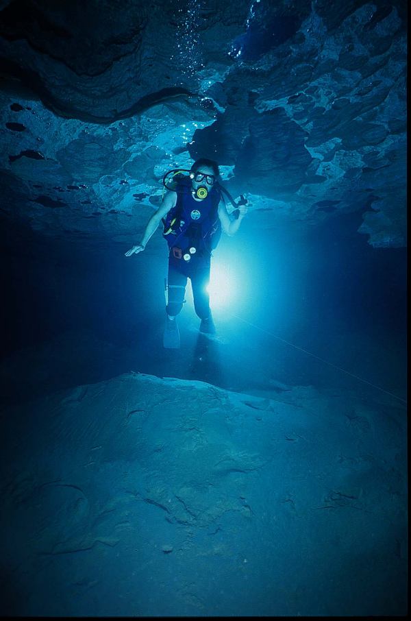
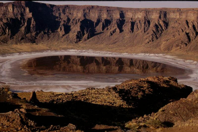
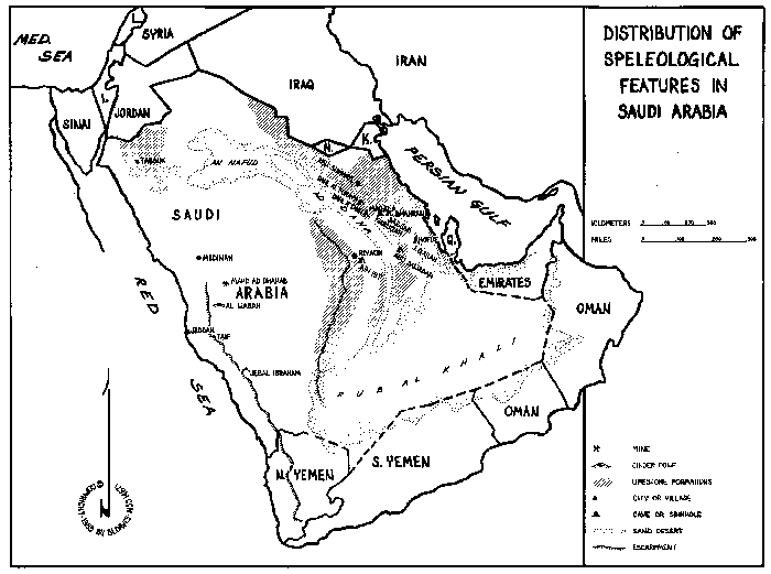
VOIDS BETWEEN THE DUNES By B.L. Davis, NSS 14671 Photos © 2005 by their respective owners I first arrived in Saudi Arabia in February, 1977 on temporary assignment from the home office in California. During that month-long visit, I managed to get two (separate) days off and I had an excellent recreational activity in mind with which to fill them: caving! Following a "lead" gleaned from a booklet published by the Saudi National Airline (1) to introduce their clients to Saudi Arabia, I located a large cave that intercepted the water table not far from Riyadh. At the time of my visit to the cave, which was known as Ain
Hit (Ain is Arabic for spring, solution pit or well), locals came to the cave
primarily to go swimming. Historically, the cave was used as a watering hole. It
was formed in the Jurassic-period Hanifa formation (2), which ran north and
south for about 900 kilometers along the western edge of the Al Dahna Desert in
the Tuwayq mountain range. The limestone was a yellow-colored rock of inferior
structure, fractured and crumbly. A great collapse resulting in a depression in
the neighborhood of 100 meters in diameter had exposed the cave's single large
chamber to the surface.
Visitors to the cave generally used the depression for a parking lot. The depression sloped downward into the cave's entrance, which was at the base of a vertical limestone cliff. The opening was 30 meters high by 60 meters wide. Breakdown more than half filled the chamber as it sloped towards the cave's terminus at about a 45 degree incline. At the bottom of the slope where the breakdown nearly met the sloping ceiling there was a crescent-shaped lake possibly 30 meters long by 10 meters wide of undetermined depth. A fair amount of natural light reached the lake from early morning until late afternoon so that artificial light was not necessary to make the nearly 150-meter trek down to the lake. I would guess the lake's surface was about 100 meters below the entrance level. It was evident the water table had been dropping recently, probably due to wells supplying Riyadh, and thus supporting the contention by some that this was fossil water. The water undoubtedly was not replenished from the surface, where the average annual rainfall was less than 10 centimeters. There were several other caves, or more accurately, sinkholes, along the base of the same limestone cliffs that Ain Hit occurred in. All were five to six kilometers south of Ain HIt. None could be free climbed, and since I had no vertical gear, I did not enter them. The first sink I encountered was visible from a kilometer away. It occurred in the alluvium halfway between the base of the escarpment and the valley floor. The entrance was nearly perfectly round and about 15 meters across. The wall belled out below the rim and reached an apparent bottom about 45 meters down. A fair-sized breakdown cone rose nearly 10 meters from the bottom. Approximately the first third of the shaft was through the alluvium. At the bottom the shadows were too dark to distinguish any passages that may have led off horizontally, but my feeling was there weren't any. Nearby I found another intriguing entrance in a small wash at the mouth of a canyon intersecting a limestone cliff. The entrance was only two meters, the smallest noted in this area. But below, the pit belled out tremendously. Twenty-five to 30 meters down, sunlight shining through the entrance hit a dirt and gravel slope that disappeared into inky darkness. Rocks thrown into this darkness rattled to greater depths. The other pits in the area were developed much the same as the first two, but didn't reach the same depths. Their floors were visible from the surface, and continuing passage was not evident. A lot of collapse features were evident on the surface all around the Ain Hit area, indicating there was (or had been) a lot of passage below. The entire limestone escarpment northwest of Riyadh was dotted with beckoning entrances. Several of these were checked out, but none were more than shelters; the deepest penetration was no more than six or seven meters.
THE EASTERN PROVINCE
In the 125 degree F heat of June we traveled 200 kilometers southeast to the Al Hasa Oasis and Hofuf. Nearby, Jabal Qarah rose above the date palm orchards. This limestone outcropping contained caves first described to us two years previously, along with ominious warning about Phlebotomous flies of Hofuf that carried the dread disease listeriosis. "Ah, yes, listeriosis," an informed authority told us. "And these fly bites also cause open sores, rapid weight loss and blindness. There is no known cure. Two Americans were bitten and were flown to UCLA Medical Center for specialized treatment. One survived..." We were visiting the caves in the middle of the day because the same authority had assured us these flies were active only from dusk to dawn. It might have been safe to visit the caves after dark provided we didn't go barefoot, since the flies reportedly were unable to fly any higher than a half-meter or so above the ground. The first cave we visited was a large shelter cave with
remnants of a wall at its entrance. At one time it was used to harbor livestock
or store forage. It was not used for human habitation. There were other shelters
in the area, plus caves in which one family had produced pottery for eight
generations.:
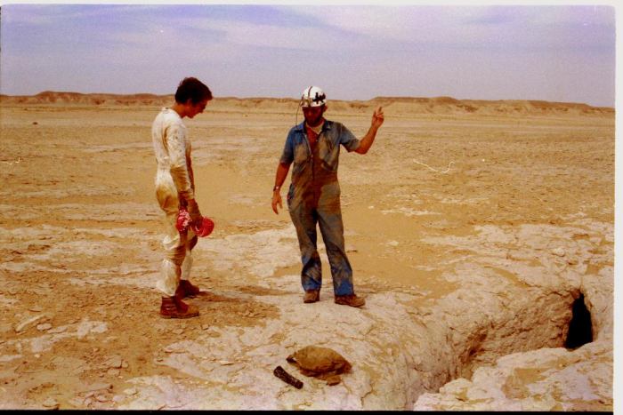
The real objective of the trip was Ghar Al Nashab (The Cave Where the Arrow-Maker Worked), or more commonly known as the Al Qara Cave(s). Ghar Al Nashab, which evidently was formed in the late Pleistocene, was a series of very deep and narrow joint-controlled fissures in a massive limestone outcropping. Most passages were opened to the sky, but cool air settled in the fissures and cascaded onto us as we approached the impressive entrance. The cave's main passage was as much as three meters wide and 30 meters high. The most distant point from the entrance was 160 meters. The twilight illuminated most of the passages during the brightest part of the day, but some passages beneath breakdown wedges attained absolute darkness for short distances. The floor generally was smooth and sloped gently toward the entrance. There was evidence of a healthy rat population in the cave, and one passage was referred to as the "bat passage" by William A. Goellner when he visited the cave prior to 1971 (3). However, no bats were sighted on our visit. Neither were any of the nasty little flies we had been warned about, but there were great numbers of the common variety. The lack of bats and abundance of rats and flies was probably the result of the recent "commercialization" of the cave and the sanitary habits of the majority of those who visit it. "Sidewalk vendors" were present at the entrance, where they offered snack food, cigarettes and non-alcoholic canned beverages that could be taken into the cave. Inside, concrete sidewalks, park benches, picnic tables and efficient but unimaginative lighting had been provided by the government at no charge to the visitor. Few trash receptacles were provided so all unwanted cans, wrappers, spoiled goods, etc. were tossed toward a dark corner or just left in place. DAHL SABSAB In July 1981 we twice failed to find a cave shown on our USGS map as a sinkhole with the name (Dahl) Sabsab. (Dahl is Arabic for cave.) It was marked some 100 kilometers from the nearest village or paved road, and 30 kilometers of that distance was across roadless expanses of sand, rock and gullies. The 70 kilometers of dirt "road" was the most miserable accumulation of ruts, rocks ridges and washboard we'd ever encountered. We saw only one other human being and a couple of camels.
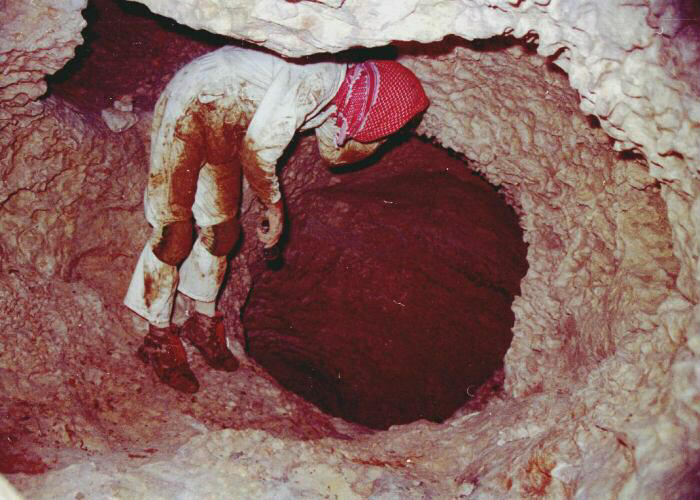
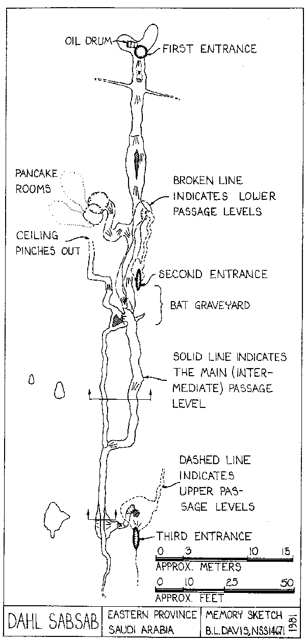
As we neared this depression, a half-dozen blue-gray pigeons flew out of the limestone. Thus, we learned a lesson in cave hunting on the Arabin Desert: pigeons issuing forth from seemingly featureless landscape was a good indication of a cave entrance. All pigeons we encountered in the "Deep" desert since that time have been a rare, unmixed breed known as the rock pigeon (4) (rock dove - editor). We found all of them roosting in cave entrances. The entrance was invisible from more than 30 meters away, but was quite impressive up close. Following our failures to locate Dahl Sabsab, we hadn't bothered to pack any caving gear on this trip and had considered it more of a reconnaissance mission. But there before us was a vertical entrance 1.5 meters across and five meters long that, at about four meters down, narrowed to less than half a meter by 1.4 meters. Then it belled out into darkness. By climbing down to the narrow point our flashlights could illuminate a 45 degree dirt slope another three meters down that disappeared beneath overburden. A rope would be necessary to investigate further. We were disappointed, but it still was thrilling to find a promising entrance in spite of the foolish decision to leave caving gear at home. We returned a week later, coming in from the north so we could check another cave --Abu Sawadah (Father of Sawadah-- shown on the map about 20 kilometers north of our unnamed cave. From the benchmark location, Abu Sawadah was an easy find. After crossing a couple of small ridges, we held the wheel straight on our vehicle and plowed across relatively flat desert until we spotted a depression with exposed limestone. As we drew near, pigeons flew from the rock. Dahl Abu Sawadah had two entrances. One was a large funnel at the lowest point of the depression, pointing toward the prevailing wind. The other was a vertical solution pit 60 cm in diameter that intersected a passage from the funnel about six meters down. The funnel was about four meters across, and 270 degrees of its wall was formed from blow sand that had spilled over the brink; the rest was limestone. From the lowest point of the funnel a single sand-choked passage continued down, passing beneath the second entrance. Just beyond that point it pinched down to crawling size, passed a one-meter drop and turned right into absolute darkness. This was the first real cave we had been in since coming to Saudi Arabia. Beyond the edge of darkness we found only about 25 meters of passage, including two small rooms. The passage sumped in blow sand, which had begun to fill the entire cave. It was quite warm inside -- just over 80 degrees F. No calcite speleothems were present, and we found one lone bat roosting in the back. He sought a more secluded crevice before we could identify him. We also found several large, black, nasty-looking carnivorous beetles. Upon exiting Dahl Abu Sawadah, we immediately retraced our tracks from the previous weekend to the cave with no name. Having flushed out the rock pigeons, I quickly rigged the seven-meter entrance drop and rappelled in. Prepared for disappointment, I wasn't too surprised to find that the dirt slope I had landed on extended down a 45 degree slope for only about three meters before ending in a sand, rock and dried mud choke. Crawling about the base of the slope were a good number of beetles such as those we saw in Abu Sawadah, and a giant black scorpion 13 cm long. I made a limited digging effort, but soon was discouraged by 105 degree heat, 95% humidity and suffocating dust. Some time later we showed pictures of the cave to Wil and Sarah Kochinski, two Aramco employees who had visited many of the caves shown on our maps. They immediately recognized it as one they had been to a few years earlier, using homemade rope ladders and block and tackle for the vertical work. At the time of their visit, the passage had ended with 50 or 60 meters of very muddy (knee deep) crawlway. Like Abu Sawadah, this cave was conveniently located to take on goodly amounts of blow sand and all run-off from flash flooding in the area. Both Dahl Abu Sawadah and the cave with no name occurred in horizontally bedded Paleocene limestone that was overlain with Miocene sediments. The caves themselves developed most extensively during the Eocene and Oligocene periods (5). BACK TO DAHL SABSAB The following week we made another attempt to find Dahl Sabsab. After several hours of exploring in ever-widening circles in the area in which we thought the cave was located, we spotted a likely depression. As we drew near, a half-dozen flapping gray objects burst from the desert floor. This was it. We found three climbable vertical entrances in the shallow depression, the first of which was a round solution dome abouta meter in diameter. It belled out at the bottom where it intersected a horizontal passage six meters down. The second and third entrances were narrow fissures 30 cm wide that followed a joint. All three entrances lay in a line and were spaced about 30 meters apart. The valley floor that Dahl Sabsab occurred in, and the floors of the other valleys within Batn As Sabsab (the greater Sabsab Basin), had flat surfaces of compacted gravel that completely concealed the limestone beneath except for a couple of isolated exposed nodules. There were no dunes of drifting sand in Batn As Sabsab, but the entrances to Dahl Sabsab had collected sand. Like Dahl Abu Sawadah and the cave with no name, Dahl Sabsab collected run-off from an area of possibly 150 square kilometers. Dahl Sabsab also shared the same geologic characteristics as Dahl Abu Sawadah, although it was 200 air kilometers further north. So much of the day had been spent searching for the cave that by the time we found it, no time remained for exploration much beyond the entrances. We checked one of the crevice entrances down a crawlway to an unclimbable drop and then returned to the other crevice entrance. It had a room about six meters wide. One passage led down through twisting passages and a few short drops to a keyhole-shaped walking passage that followed a limestone joint. The last weekend in September was stretched to an extravagant two days to allow ample time to relocate Dahl Sabsab and spend sufficient time exploring and photographing it. Finding it again was a cinch. Exploring it was great fun. All three entrances connected underground. Development of the cave was generally along joints in the limestone bedding. The trunk passage sloped gently downward. picking up tributaries along the way. Occasional drops were encountered, the largest only about five meters. There were no large chambers, but there were two pits or solution domes 12 to 15 meters deep. All areas of the cave were accessible without rope. At the lowest point of the cave the trunk passage choked with gravel washed in from the surface. Total length of all major passages probably didn't exceed 100 meters, and the depth was about 20 meters.
We did not survey, although the Kochinskis told us later that someone had mapped Dahl Sabsab a few years ago. The whereabouts of that map was unknown. The next day we searched for another pit entrance indicated on the map approximately 35 air kilometers southwest of Sabsab. No name was given on the map but we later learned it was Al Dahl Al Jabel Al Kahliqah. We did not locate it. Before night we headed back toward civilization. But about halfway out to Al Mutala and Uray'irah our truck died. We had not seen a living soul since leaving the paved road two nights earlier, but not 100 meters from where we broke down were two Bedouins sitting in the shade of an overhanging outcropping. They came down to investigate, and after the usual greetings invited us to join them for a meal. My first concern though was to get our fuel line repaired, so we told the Bedouins we'd be right over. When our repairs were completed, we drove over to join our hosts. And there, in the 110 degree F. shade, cooking over a camel dung fire, was Arab spiced rice, chicken and Lipton's tea with the customary large dose of sugar. Mealtime conversation was limited to our 30-word Arabic vocabulary and the 100-word English vocabulary of one of the Bedouins. Between mouthfuls of rice and chicken, taken from the pot with your fingers, several topics were discussed: Us - We come from California, U.S.A. Americans. (Good). We live and work in Saihat, K.S.A. (Oh, not a good place).Them - They are brothers. Ahmed and Mohammed. Ahmed drives. World Travel- Mohammed (who speaks English) has been to London. For an operation on his eyes, (80% blind). They used to live in Jiddah. (Good). They've been to Yemen and East Africa. (Good) And, of course, Europe. Camels - They have eight. They are herding them to market in Al Mutala. The camels are one year olds and will bring S.R. 800 ($240) each. It will take two days to get there from here. Caves - They know of Dahl Sabsab. They know that some foreigners went there a year ago. They don't know of any other dahls. Why do we want to go in dahls? Cameras - Did we have one? (Yes). Would we take a picture of them in their truck? (O.K.) By the time we all finished eating, the camels had wandered out of sight ... on a nearly flat desert. The trucks were loaded very quickly and off we sped in search of the camels. We found them about three kilometers away. Ahmed skillfully rounded them up with his one-ton Chevy and herded them back toward the tracks to Al Mutala. Now there was time to pause for a photograph. Ahmed and Mohammed were quite visibly disappointed when they discovered that our camera didn't make instant photos. When the film came back from the lab we were dismayed to find that none of the pictures in the cave came out. The flash was out of sync. But we did have some great photos of Ahmed's truck. During the 1982 New Year's weekend we made one more trip to Sabsab and very carefully took pictures of its features. These came out O.K. REINFORCEMENTS ARRIVE In February we learned that we no longer were the only
regulation American cavers in the kingdom. John and Susy Pint had come to
After lunch we moved to the west side of the highway and climbed to the top of the higher ridges. Suddenly several blue-gray pigeons shot up from a crevice in the rock and circled into the distance. The crevice was 60 cm. across at its widest point, and the bottom was not visible. A rock rattled down at least 20 meters. But we later found we merely were in the narrow, upper end of a surface canyon formed by erosion. An ample amount of pigeon droppings coated the walls of the fissure and sustained a fair population of flying insects. Geologic features and descriptions were very similar to those of Ghar Al Nashab at Al Qara, 40 kilometers southeast. For several months the Kochinskis had been talking about investigating a deep pit just south of Kuwait that they had been unable to bottom with their rope ladder or block and tackle. A grand two-day trip was put together in mid-march to visit Dahl Abu Sukhayl (Father of Sukhayl Cave). Wil, Sarah, John, Anna and I with two 4x4s made up the Party. The cave was 160 kilometers south of Kuwait and 200 kilometers west of the Persian Gulf. To find it from the nearest charted civilization, Wil and Sarah led us down long-abandoned Aramco “drag roads" of which many were shown only on “classified” Aramco maps they somehow had obtained. When the last charted road was followed to the point nearest the cave, still 12 air kilometers away, Wil took off cross-country toward the area’s most prominent hill (Jabal Al Ku) and drove to its peak. At the top we all took compass bearings on another hill some 10 kilometers away, and we repeated the process until we entered a medium-sized valley nearly devoid of any living things or distinguishing features. Every kilometer we drove across this valley intercepted another intriguing shaft in the limestone. All entrance locations were confirmed by the customary flight of rock pigeons. Every pit we looked into was at least 20 meters deep. Some were narrow fissures or small-diameter solution tubes that sank into impenetrable darkness and silently swallowed the stones we dropped in. Others were nearly 10 meters across at their entrances and belled out into large chambers below. None could be free climbed. Wil and Sarah had dropped into most of these Pits with their
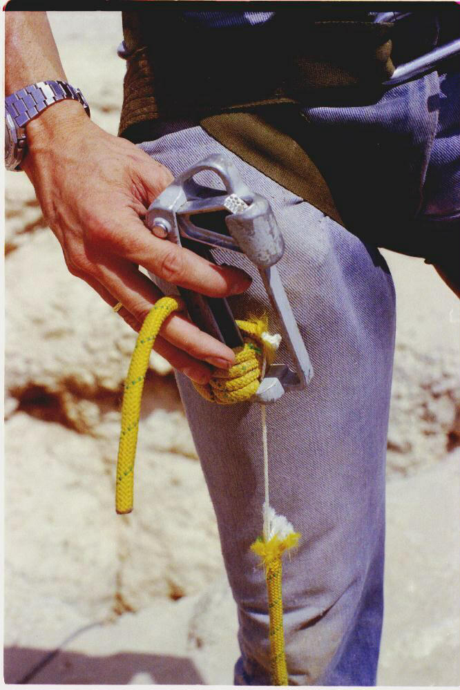
homemade rope ladder made up of 3/4-inch synthetic fiber rope with 1/2-inch
plywood rungs held in place by nails pressed halfway through the rope beneath
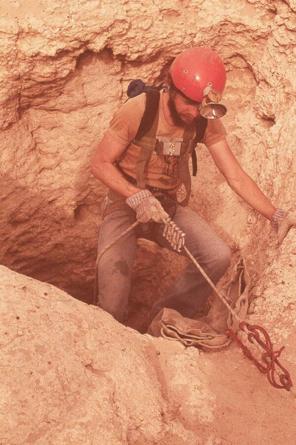
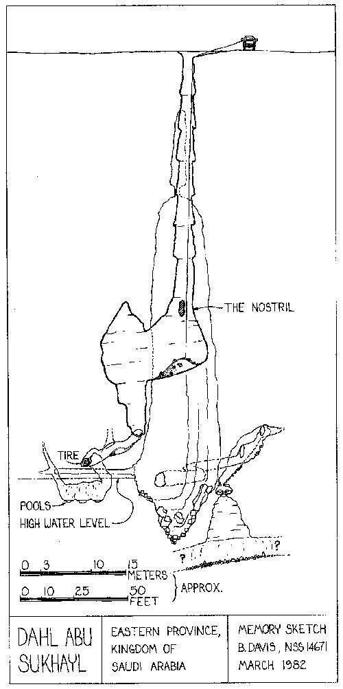
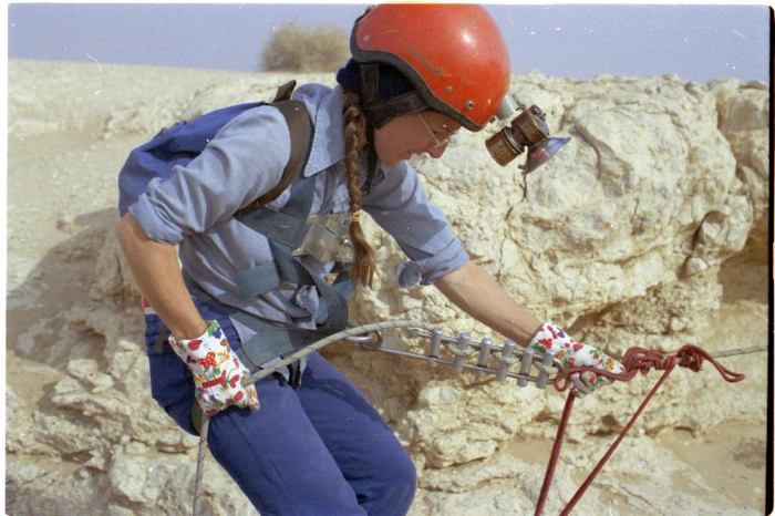
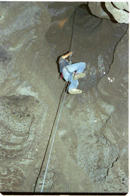
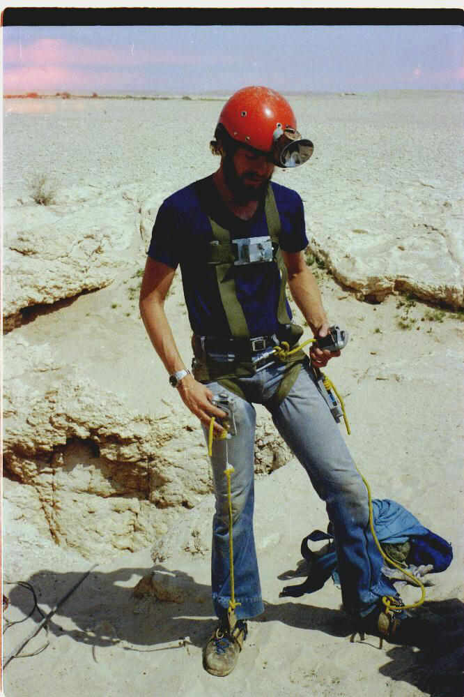
each rung. No continuing passage had been found at the bottom of any of t DAHL ABU SUKHAYL From the surface, Dahl Abu Sukhayl didn't appear to be especially outstanding. The cave had swallowed the overburden of Miocene sediments and blow sand at its entrance to expose solid, horizontally bedded Paleocene limestone. A joint intersected the two-meter diameter shaft and this had developed into a trough on the surface that channeled all run-off into the shaft. Only 30 meters away were two more pits. One was less than a meter in diameter; the other was 10 meters across and opened into a large breakdown chamber with a floor visible about 25 meters below the surface. Will thought the small entrance connected to the breakdown chamber, but definitely no other passages led away from it. We rigged a 60-meter PMI rope into the Abu Sukhayl entrance
drop. This flushed out a few more pigeons. But when all the rope was in the pit,
it just didn't feel as if it were on bottom. Out it came and a 90-meter Blue
Water II was put in its place. I was first down. It was my first vertical cave
in nearly four years, and it most certainly was a virgin cave (6). Imagine the
exhilaration! The shaft maintained a uniform diameter all the way down. There
were many small ledges and crevices along the walls where the pigeons roosted.
Several nests had eggs or squabs. About three-quarters of the way down a natural
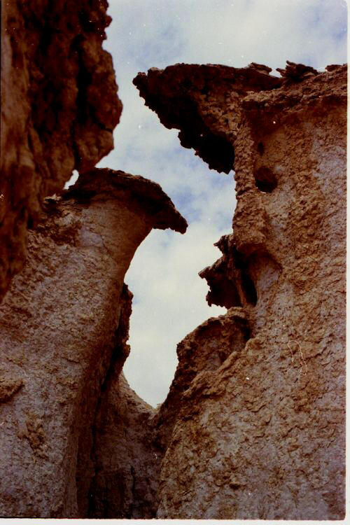
bridge occurred that gave the appearance of rappelling into one nostril of a
giant, up-turned nose. At the bottom of the drop was a large pile of decaying matter, including a couple of sheep or goats, mangled chunks of rusting metal and a tremendous amount of pigeon droppings ... along with a lot of sand and swarms of beetles and gnats. The air was surprisingly cool for an Arabian cave -- below 70 degrees F. - so there was no unbearable stench. The room at the bottom of the drop was good sized: 30 meters long, by 15 wide and 15 high. Just offset from the drop was a second drop that had a much cleaner breakdown floor.
Near the end of this passage a window opened into a fair-sized room. A talus slope began at the ceiling at one end of the room and terminated at the brink of a dark void at the bottom of the other end. Sarah, John, Anna and I explored to this point the first day and decided to save the dark void for Wil who had volunteered to stay above-ground and guard the rope. We hoped Wil would find a room with some regulation calcite cave formations. We had seen none in the rest of the cave. A CHANGE IN THE WEATHER Upon exiting the cave, we found ourselves in the midst of an Arabian desert delight: a shamahl, in which winds exceeded 100 kph with dust so thick that visibility dropped to less than 10 meters. Sand stung our faces like 10,000 needles. While the wind tried to blow away half our camp gear, the dust and sand penetrated every micro opening in what was tied down, including food, sleeping bags, cameras, vehicles, clothes, etc. We derigged the cave and relocated camp to the semi-shelter of a low hill nearby. While we re-rigged the entrance pit the following morning, a number of Bedouins happened by. They couldn't imagine why we would want to go down in that hole. Our women went down too! Were we looking for water? Oil? Gold? To them, as with too many other people around the world, such a hole was only good for disposing of such things as old tires, sick animals, rubbish and the like.
John stayed above this time. The rest of us quickly showed Wil through the cave and proceeded to the brink of the "dark void," which turned out to be a ceiling entrance to a small room beneath the breakdown. Gently we lowered ourselves to the floor of this new room, only 1 1/2 meters below. The ceiling appeared ready to collapse at any moment. A slight draft carried our breaths up through the hole in the ceiling. The air was coming from a hole behind two large, round stones at one edge of the room. This hole was a vertical shaft that opened into a passage at least 10 meters below. The floor of the passage was paved with mud-coated, rounded cobbles, but neither Wil nor I could spot a route down without rope. Our only other rope was the 60-meter PMI that we had left above. Beside the fact that there was nothing stable enough from which to tie off, not enough time remained in the day if we expected to find our way out of the desert after dark. On top of that, by the time we had returned to the bottom of the entrance drop it had begun to rain outside. A steady drizzle was falling down the shaft. Topside, the wind had come up again to help the rain make
de-rigging and lunch miserable. However, we took time to measure the rope. To
the bottom of the first drop: 46 meters; to the bottom of the second: add eight
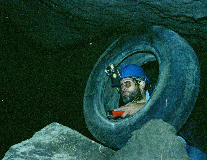
meters. It was the second week of April before we returned. The Kochinskis were off on a week-long expedition (Aramcons have time for things like that) so it was just one vehicle with Frank, John, Anna and me for just one night and one day. Once in the area, we relocated the cave after an hour of searching. John got stuck with first watch on the rope. Frank dropped in first, followed by Anna and me. When we reached bottom, Frank took off down the passage
toward the truck tire. Anna and I put our gear in order and followed. He was
waiting near the tire. When we arrived, he asked which way to go from there.
That was an odd question; there was only one obvious route. But when we looked
down the passage below the tire, the problem was obvious. Water filled the
passage to the ceiling! Ours may have been a narrow escape the time before. This
may also explain why no evidence of bats was encountered in such a large cave. There was nothing else to do but climb back out and tell John the discouraging news. Exploration beyond the third drop and surveying would have to wait indefinitely. Frank went out first, followed by Anna. I brought up the rear. About three meters from the top of the rope climb, a terrible “sinking" feeling came over me, as though the rope was stretching too much. There was resistance as my right leg thrust downward but not enough to propel my body upward. A quick check of the sling (8mm Perlon ) revealed that its sheath and all but one core strand had severed just below the jumar. It was another narrow escape. I'm glad I use a three-ascender system.
On a Wednesday night, we drove beyond the last blacktop until we lost our bearings and camped. The following morning found us back on course and headed out beyond the area of Dahl Sabsab quite early. Not far from our destination we encountered a mini-pickup with three Bedouins. They flagged us down. The driver was wearing a .38 cal automatic in a shoulder holster. He got out and indicated to Wil (who can speak some Arabic) that his pickup had some sort of engine trouble. Everyone had a look. The charging system was hyperactive and had fried the battery. There was nothing we could do but add water. They didn't have any, even for drinking, and it was at least 110 degrees F. So of course they wanted us to give them some. Wil has an 80-liter water tank built into the floor of his Land Cruiser with a "faucet" protruding beneath the rear bumper. He told them to help themselves. You can't imagine their excitement over a Land Cruiser that made water from nowhere! Soon after parting ways with the locals (who said they knew nothing of Al Dahl Al Jabel Al Kahliqah or any other dahls) we reached the sinkhole. It was more than 30 meters in diameter and 15 meters deep with a floor that funneled into a small opening at the deepest point. The limestone in which the cave had developed was a pale orange color. Geologic characteristics were similar to those of Dahl Sabsab some 35 air kilometers to the east.
Inside the hole was a wide crawlway with a sand floor that had been channeled at one edge by water. Still within the twilight zone, a “squirming"-height passage intersected from the left. We followed the main passage, which had become stooping height and had widened out. It became wide enough and high enough (three meters) to be considered a chamber where the passage took a 90 degree bend to the right. Walking passage continued to another good-sized chamber from which a low portal led into a small standing-height room. One pigeon flew deeper into the cave instead of following the others out. It stayed just ahead of the light cast by our headlamps and became cornered in the last room. We provided an escape route and watched as it flew cautiously back toward the entrance 100 meters away. This pigeon passage had a floor of sand and silt and was nearly level from wall to wall. Not long before our visit the entire passage had been flooded. Moisture was still evident in the sand and "'bathtub" rings of damp organic matter clinging to the walls and to the two-meter ceiling of the last room. Despite its humidity, the 80 degree F. air of the passage seemed cool in contrast to the blast furnace outside. A second entrance led into the cave from higher up along the wall of the pit. Dropping through breakdown for six or seven meters, this entrance intersected the "'squirming height' passage about 15 meters from the pigeon passage. The 10-meter-long squirmway had a floor of broken rock, along with dried prickers that had been swept in by the elements and a lot of stale dust. Beyond the intersection with the second entrance this passage enlarged to crawling height. The middle third of the passage was walking height and had a sandy floor. Digging in the sand was required in several places, and Wil thought more passage had opened up since his previous visit a couple of years prior. It was evident that a fair stream of water had passed through during the recent rain.
All except one of us used Wil’s treacherous ladder to climb out of the pit (John Pint prusiked out). At least the ladder provided a more certain exit than a hopeless pile of stones that had been. stacked against the lowest overhanging wall by some unfortunate being in the past. Not long after this trip, my employment in Saudi Arabia was terminated indefinitely, and in August 1982 Anna and I left for Europe by car. Many leads remained to be checked, especially out on the As Sulb Plateau, which was another half-day journey by 4x4 across undeveloped desert west of Al Dahl Al Jabal Al Kahliqah (near Maqala). This may be the most promising caving area in Saudi Arabia. We envy those who may be awarded this opportunity in the future. FOOTNOTES (1) Across Saudi Arabia, pg. 121: Falcon Press & Saudia Photographic Dept., Jeddah, K.S.A., 1978 (?). (2) Atlas of Saudi Arab, Map 13; Hussein Hamza Bindagji, Oxford University Press, England, 1978. (3) A Guide to Hofuf and the Jebal Qara Area of the AI Hasa Oasis, Saudi Arabia. William A. Goeflner, Dhahran School, K.S.A., 1974, (First printing October 1972). (4) Verbal comment by John Burchard, a Naturalist employed by The University of Petroleum and Minerals in Dhahran,. K.S.A. (5) Quaternary Period in Saudi Arabia, pgs. 166-172: Edited by Saad S. AlSayari and Josef G. Zotl, in cooperation with The University of Petroleum and Minerals, Dhahran, K.S.A., and the Austrian Academy of Sciences, Vienna. Austria. Springer-Verlag, Wien & New York, 1978. (6) The local inhabitants possess no facilities for gaining access to pits of this depth, nor the desire. Aramco surveyors plotted the location of many caves in eastern Arabia many years ago, but did not explore them. Other than the Kochinskis, and a Dr. Oertley and a Mr. Del Oro, no one else is known to have shown any interest in the caves of Abu Sukhayl. (7) Journal of the Saudi Arabian Natural History Society. No. 17, pgs. 4-12: Iyad A. Nader (Dept. of Zoology, University of Riyadh), Jiddah, K.S.A.. June 1976
|
![Visitors follow a paved walkway into Al Qara Cave]](../gallery2001/qaracavehofuf.jpg)