|
By John Pint
 In
1992, archaeologist Phil Weigand
published sketches of several
circular pyramids and a ball court he had found in the hills
above Santa Rosalía, eight kilometers north of Etzatlán. Ever
since I came across his drawings, I had wanted to visit these
ruins in the company of an archaeologist who might explain what
I was seeing. Weigand said that these ancient monuments are “in
excellent condition” but also mentioned that the climb up the
hill is very steep and you’d better bring along “water, food and
a telephone in case of emergency.” In
1992, archaeologist Phil Weigand
published sketches of several
circular pyramids and a ball court he had found in the hills
above Santa Rosalía, eight kilometers north of Etzatlán. Ever
since I came across his drawings, I had wanted to visit these
ruins in the company of an archaeologist who might explain what
I was seeing. Weigand said that these ancient monuments are “in
excellent condition” but also mentioned that the climb up the
hill is very steep and you’d better bring along “water, food and
a telephone in case of emergency.”
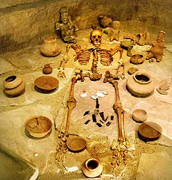
On top of all that, I learned from the President of Etzatlán
that one of the deepest shaft tombs ever known had been found in
these very same hills. This tomb, known as El Frijolar, measures
16 meters deep and has three large interconnected chambers at
the bottom of the narrow shaft, which is 1.5-meters in diameter.
These burial chambers have been reproduced in fascinating detail
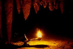
at the Museo Oxiacar inside the Casa de Cultura in Etzatlán. The
shaft tomb was dug by the same mysterious people of “The
Teuchitlán Tradition” who—starting as far back as 2300 years
ago—built their trademark circular pyramids all over what is now
called western Mexico.
While planning my visit to Santa Rosalía, I managed to find not
just one but three archaeologists willing to participate in an
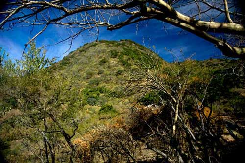
excursion to these ruins which Weigand had found atop El Peñol,
a high hill located just three kilometers north of Santa Rosalía.
I had waited for the rainy season to calm down somewhat and
finally decided to tackle El Peñol on September 16, Mexican
Independence Day. A dozen of us would-be adventurers met early
one morning outside town under an ominous sky filled with big,
black clouds.
Sad to say, even though it was a national holiday, Murphy’s Law
was still operating: just when we were ready to drive off, rain
started to fall from the sky in buckets. We were strongly
tempted to call the whole thing off, but archaeologists Rodrigo
and Cyntia Esparza had arranged for a corn-on-the-cob and
fried-fish picnic after the hike, a treat we couldn’t afford to
pass up just because Tlaloc was in a bad mood.
The head of tourism in Etzatlán had arranged a guide to meet us
in the plaza of Santa Rosalía, but hadn’t mentioned the guide’s
name. No problem, I thought, because I had expected to find the
plaza empty with only the guide waiting for us.
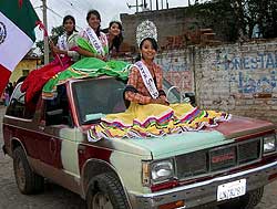
False assumption! As it was Independence Day, “downtown” Santa
Rosalía was jammed with people watching a parade which had just
begun. The first “float” coming down the street was a pickup
truck bearing Señorita Santa Rosalía on its hood with her Ladies
in Waiting on the roof. Next came a brand-new, shiny red tractor
pulling a nicely decorated flat trailer carrying all the old
ladies of the area, dressed in their holiday best. “We honor our
old-timers this way so we won’t forget our ancient roots,”
explained a tall and hardy young man, who, as luck would have
it, turned out to be the very person we were looking for, our
guide, Omar Preciado.
Having enjoyed the parade (which apparently included only those
two vehicles) we asked Omar about the state of the road between
Santa Rosalía and the foot of El Peñol. “It’s only three
kilometers,” said Omar. “We’ve paved part of it with
cobblestones, but a high vehicle is needed for the last
kilometer and a half.”
So it was that all thirteen of us somehow managed to squeeze
(and I do mean squeeze) into two Jeeps, which then bumped their
way along the road until we reached a clearing in a cornfield. A
light drizzle fell as we started walking up a narrow path. Along
the way, our archaeologists Rodrigo, Cyntia and Bruno Calgaro,
pointed out ancient walls and flattened places indicating that
all of El Peñol was once beautifully terraced. “These were both
for residence and for agriculture,” they remarked.
In only half an hour, we reached the top of the hill, a gain in
elevation of about 200 meters. The first ancient structure we
came to was a ball court perhaps 80 meters long. Unfortunately,
in modern times somebody decided to build a stone wall right
down the middle of it. The very fact that the ball court is
there, of course, indicates that this was a rather important
site.
A few minutes later, we saw two large circular pyramids with the
same design as the famous Guachimontones of Teuchitlán: a high
central mound surrounded by a flat, circular walkway around
which a number of platforms are evenly spaced. Two thousand
years ago, a tall pole rose from the mound, from which voladores
or bird men, attached to ropes, may have “flown,” eventually
landing on the conveniently circular runway. Perched on the
platforms had been buildings for religious or civil purposes
like visiting the bones of ancestors or paying taxes. The
walkway was also used for a dance called La Cadena, consisting
of several huge rings of dancers linked arm in arm, encircling
the pyramid.
The beauty of these monuments atop El Peñol is that they are
still intact after all these years. You don’t need an
archaeologist’s eye to recognize the mounds, walkways or even
the platforms, so the feeling that you have somehow gone back in
time is much stronger here than at sites which have been
restored. I suspect camping up here would be quite an
experience.
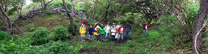
Our
gang of explorers pose for a group picture on the circular
walkway around a pyramid visible in the background. Hey, how
many Jorges do we have here, anyway?
“There are no dates from this Peñol,” wrote Weigand, “except
through comparative studies in architecture and ceramics.
Therefore, it is undoubtedly late Formative in date (the same as
the Guachis), and it served as a terraced fortified site
protecting one of the several accesses into the core of the
Teuchitlan tradition.” Chris Beekman adds, “If you continue up
the hill beyond the site, you will be rewarded with a little
group of constructions on the very top and a view down into the
area around Llano Grande.”
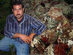
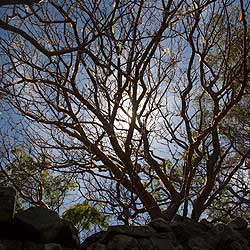
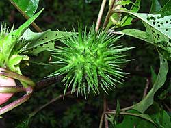
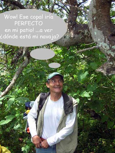 Not
surprisingly, there are a lot of copal trees on El Peñol, which
are a source of resin for incense. There is also a staggering
number of JimsonWeed plants, (Datura stramonium or
toloache in Spanish), still used today to make love potions
and worse. I wonder if these are descendants of trees and plants
used by the ancient builders of the pyramids in their
ceremonies. Not
surprisingly, there are a lot of copal trees on El Peñol, which
are a source of resin for incense. There is also a staggering
number of JimsonWeed plants, (Datura stramonium or
toloache in Spanish), still used today to make love potions
and worse. I wonder if these are descendants of trees and plants
used by the ancient builders of the pyramids in their
ceremonies.
We returned by heading south down a different path, which took
us through beautiful terraces and past a small rock mound which
may house a burial. After an extremely leisurely round-trip trek
of two hours and 45 minutes, we were back at the Jeeps and ready
for our picnic.
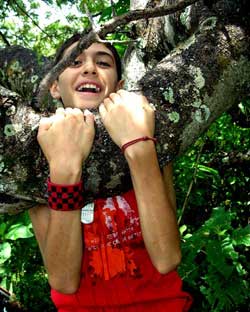
Guadalajara Muralist
Jorge Monroy
eyes a copal tree.
"Wouldn't this look
great in my patio?"
he muses while
reaching for his
pocket knife.
How to get there
You can contact guide Omar Preciado at cell phone 386-104-5632
or email preciaddo83@hotmail.com (yes, double d). To get to
Santa Rosalía, first drive to Tala. From there drive 1.4
kilometers toward Ameca and take the road to Teuchitlán and
Etzatlán. Upon arrival at the entrance to Etzatlán, turn right
onto the road to Magdalena and drive 4.7 kilometers north to San
Pedro. Proceed west from San Pedro 2.5 kilometers to Santa
Rosalía. Don’t forget your hiking or tennis shoes. Driving time
to Santa Rosalía is about 80 minutes whether from Guadalajara or
from Lake Chapala via the Circuito Sur.
|