|
 By John Pint By John Pint
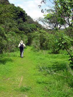
One day, my friend Chale and I decided to hike along Rio
Caliente, the hot river in the Primavera Forest, to see where it
goes. We ended up finding a new and surprisingly easy way to
reach one of the finest jewels of the forest.
Our plan was to follow the river downstream to a place called
Guava Beach, described in our book, Outdoors in Western Mexico.
We walked west along the foot of tall, verdant hills and high,
steep cliffs. We passed a gorgeous yellow Strangler Fig tree
which somehow resembles a tall damsel elegantly seated on a big
rock. As we wound our way down to Guava Beach, after an hour’s
walk, we came to long, wide meadows and several cool springs: a
perfect place to camp.
Beyond Guava Beach, our trail narrowed and took us into heavy
bush only a few meters above the bubbling river. We were afraid
the path was about to dwindle to an ignominious end, when
suddenly we stepped into a wide clearing and blinked in
surprise.
We were standing at the edge of a road—where there should be no
road—and off in the distance we could see the roof of a large
building. Tacked to a tree was a big sign reminding us not to
pick plants or disturb the wildlife.
“Where are we?” we asked each other simultaneously. With
wondering eyes, we followed the road, which paralleled the river
and revealed numerous pools of water created by rough boulder
dams stretching across the six-meter-wide river bed. I pulled
out my thermometer and took the temperature of the water: a nice
warm 35° C (95° F). “Chale, I think we’ve just arrived at
Paradise.”
We spotted only two cars as we walked along the road. All around
us, on both sides of the river, were green meadows and rocky
hills, a pristine hiking area we had never dreamed could be
within easy reach.
We soon found out we were at the far end of the least known road
leading into the Bosque de la Primavera, under the
administration of the Forest authorities and accessible to
anyone who pays the ten-peso-per-person entrance fee. Where this
fee goes is anyone’s guess, as the road is poorly maintained and
there are no facilities of any sort.
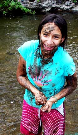
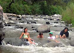
A week later, we were back with kids and adults to find out just
how “cool” this warm river was. It took us only twenty minutes
to get there from highway 70 (the road to Ameca). The children
jumped right into the froth and declared it was definitely
“chido” which is the highest compliment Mexican kids can give
anything. I thought Susan and Lupita, two UDG administrators,
were going to join me for a hike, but the moment they submerged,
they refused to come out. “Oh, this is so soothing,” they
chortled, sitting in the swirling rapids that massaged their
backs. At the end, they declared El Rio Salado to be the
ultimate stress reliever and suggested the entire UDG faculty
might do well to spend some time there.
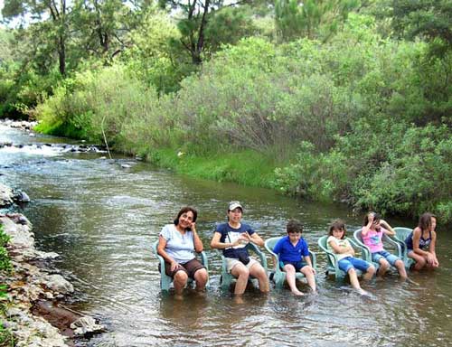
The Salty River is, in fact, simply a continuation of Rio
Caliente with all the benefits of its mineral content (including
lithium) but with a much more reasonable temperature, which
allows you to soak as long as you want without feeling scalded.
As usual, visit this place on a weekday. The road is not in the
best of shape, but a friend’s ordinary passenger car made it all
the way, even through four ominous-looking (but not deep)
monster puddles. The trick to reach this place easily is always
to follow the main (most trafficked) road. Remember, even if
those puddles make you nervous, the ultimate stress-reliever is
only twenty minutes away.
How to get there
Take Highway 15 (Nogales) 25 kilometers west of the Periférico
to Highway 70 (Ameca). Don’t get on the toll road by mistake! Go
southwest on 70 toward Ameca for about 3.5 kilometers at which
point you are about to cross over a bridge which you could
easily miss if not watching intently. Immediately after crossing
the bridge, turn left onto an unmarked dirt road heading
southeast. Follow the main drag until you come to a fork with a
big sign advertising a balneario. Don’t go to the balneario, but
bear left and you’ll soon come to some lavish buildings (private
property) and a young man who will collect the entrance fee. One
kilometer later, you are at the bathing area. Take your pick
anywhere along the river. Driving time from Guadalajara is less
than one hour. This is also reachable from the Lake via
Jocotepec, Santa Cruz and Tala. The turnoff to the dirt road is
about 11 kilometers northeast of Tala. If you have a GPS, the
turn is at 13 Q 643764 2292474 using UTM coordinates.
|